Trail Walking Municipio Tarija - Tarija - Photo
© OpenStreetMap contributors
Length
Length
2.8 km
Max alt
Max alt
1878 m
Uphill gradient
Uphill gradient
12 m
Km-Effort
Km-Effort  
2.9 km
Min alt
Min alt
1870 m
Downhill gradient
Downhill gradient
11 m
Boucle
Boucle
Yes
Creation date :
2023-11-28 14:38:01.0
Updated on :
2023-11-28 18:16:06.939

(0 Reviews)

Walking
Walking
56m
Difficulty : Easy

Scan this QR Code to open this trail in the SityTrail application

FREE GPS app for hiking

Logo SityTrail SityTrail

IGN / Geographical institutes

Download SityTrail from the App Store Download SityTrail from Google Play

Logo SityTrail SityTrail World

The world is yours!

Download SityTrail from the App Store Download SityTrail from Google Play Download SityTrail on Huawei AppGallery

About

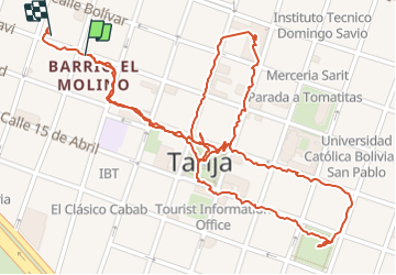
Trail Walking of 2.8 km to be discovered at Tarija, Provincia Cercado, Municipio Tarija. This trail is proposed by papounet32.

Elevation profile

Photos

Positioning

Country:
Bolivia, Plurinational State of
Region :
Tarija
Department/Province :
Provincia Cercado
Municipality :
Municipio Tarija
Location:
Unknown
Start:(UTM)
320144 ; 7617979 (20K) S.

Trails nearby

Trail Car Municipio Tarija - Visite enfants - Photo
Car
papounet32

Car

Municipio Tarija, Tarija, Provincia Cercado, Bolivia, Plurinational State of
100 km | 155 km-effort
2h 36min
No
Trail Car Municipio Tarija - Trajet incuentro hôtel Carmen - Photo
Car
papounet32

Car

Municipio Tarija, Tarija, Provincia Cercado, Bolivia, Plurinational State of
2.3 km | 2.4 km-effort
11min
No
Trail Car Municipio Villa San Lorenzo - Curry et col - Photo
Car
papounet32

Car

Municipio Villa San Lorenzo, Tarija, Provincia Méndez, Bolivia, Plurinational State of
150 km | 205 km-effort
3h 45min
No
Trail Walking Municipio Tarija - tarija hôtel vers Pib et retour - Photo
Walking
papounet32

Walking

Very easy
Municipio Tarija, Tarija, Provincia Cercado, Bolivia, Plurinational State of
4.5 km | 5.4 km-effort
2h 38min
Yes


Close
My subscriptions